 TrackMedia
 TrackRev

About AITrack
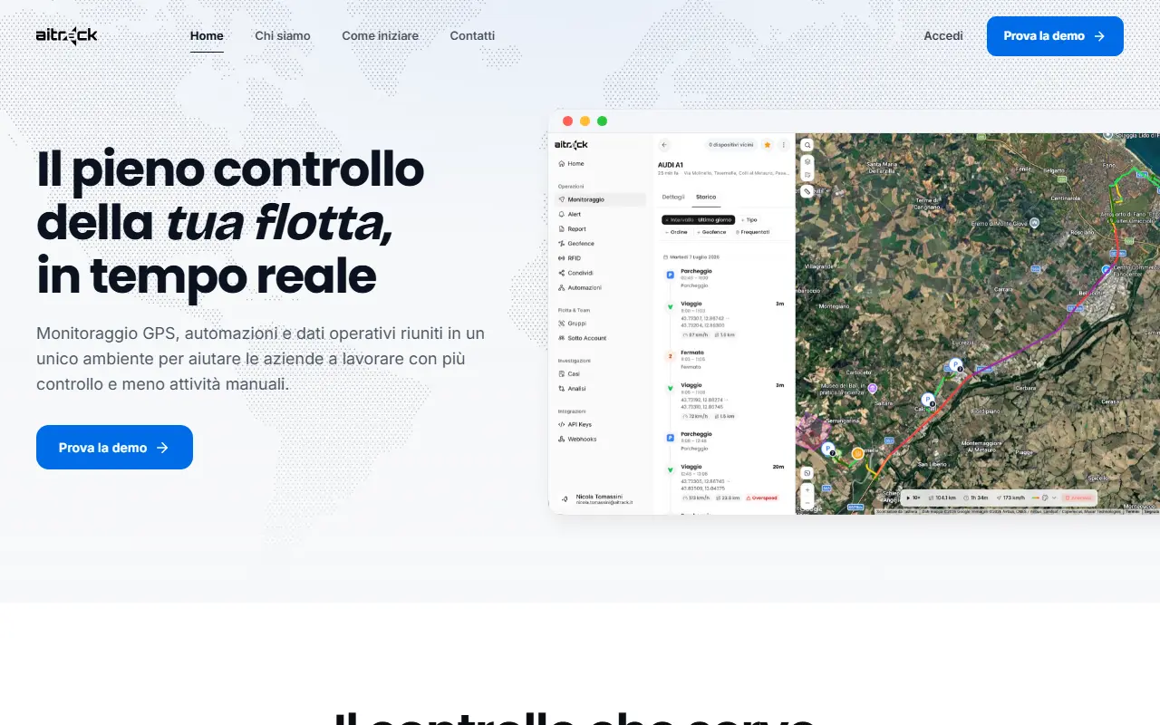
AITrack brings GPS positions, automations and operational data into one environment for companies that run vehicle fleets. A map, dashboard and mobile app stay aligned, so a manager can see where vehicles are, what they are doing and their status, with groups of devices, KPIs and scheduled reports.
Automations such as entering a depot area or a stop longer than 30 minutes can trigger notifications, and the platform lists geofences, multi-channel alerts, remote commands, sub-accounts with permissions, history with replay and a heat map. Positions are described as chained and signed so history is easier to verify.
Access is through the web and through iOS and Android. Existing GPS trackers can be reused after the model and protocol are checked. A public API and webhooks come from the Professional plan, and activation starts with a conversation about the fleet.
Key features
- Live vehicle status on map, dashboard and app
- Geofence areas, alerts and permissions
- Signed position history for easier verification
- Passkey and two-step sign-in
- Public API and webhooks from the Professional plan
- Position, alerts and history on iOS and Android
Good fit for
- Tracking vehicles in real time
- Geofence alerts for depot entry
- Scheduled fleet reports
- Reviewing past routes with replay
AITrack: questions and answers
- What is AITrack used for?
- AITrack is a fleet-tracking platform with real-time GPS monitoring, geofence automations, alerts and reports, reachable from web, iOS and Android. It is a good fit for tracking vehicles in real time, geofence alerts for depot entry and scheduled fleet reports.
- Is AITrack free?
- Yes. AITrack has a free plan.
- Is AITrack open source?
- No. AITrack is proprietary (closed-source) software. In the Maps & Navigation category, open-source options include OpenStreetMap, Organic Maps and Dawarich.
- What are some alternatives to AITrack?
- AITrack competes with Samsara, Route4Me and Onfleet.
Open-source alternatives to AITrack
See all
OpenStreetMap
Maps & Navigation
The Rails application that powers OpenStreetMap
GPL-2.0vs Google Maps★ 2.9k
Organic Maps
Maps & Navigation
🍃 Organic Maps is a free Android & iOS offline maps app for more than 6M travelers, touri
OSSvs Google Maps★ 16k
Dawarich
Maps & Navigation
The private alternative to Google Timeline. Import your location history, keep it forever.
AGPL-3.0★ 11k
OsmAnd
Maps & Navigation
OsmAnd
OSSvs Google Maps★ 6.1k
Wanderer
Maps & Navigation
wanderer is a self-hosted trail database. Save your adventures!
AGPL-3.0vs Komoot★ 4.1k
iD
Maps & Navigation
🆔 The easy-to-use OpenStreetMap editor in JavaScript.
ISC★ 3.9k
SaaS alternatives to AITrack
See all
Samsara
Home Automation & IoT
Connected operations cloud for fleet, equipment and site monitoring
SaaS
Route4Me
Maps & Navigation
Route planning and delivery optimization software for fleets
SaaS
Onfleet
Maps & Navigation
Last-mile delivery management software with dispatch, routing and tracking
SaaS
Track My Geo
Maps & Navigation
Turns everyday phones into fleet GPS trackers with real-time locations on a map and alerts
SaaS
OptimoRoute
Maps & Navigation
Route planning and scheduling software for delivery and field service teams
SaaS
Routific
Maps & Navigation
Delivery route planning and optimization software
SaaS